 |


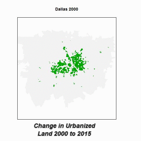


Urbanized land is defined as having greater than 1 housing unit per acre. Estimation was made by calculating housing density using the Decennial Census and American Community Survey Block-Group Data. Block-Group GIS shapefiles were rasterized to 100 meters x 100 meters to create the maps above. GIS work was done using R.